Msimbazi middle basin
Location
Dar es Salaam, Tanzania
Project type
Flood management feasibility study & urban development scenario
Year
2020-2021
Client
GIZ
Collaborators
CDR International BV, Wema, DASUDA, Lucas Kukler
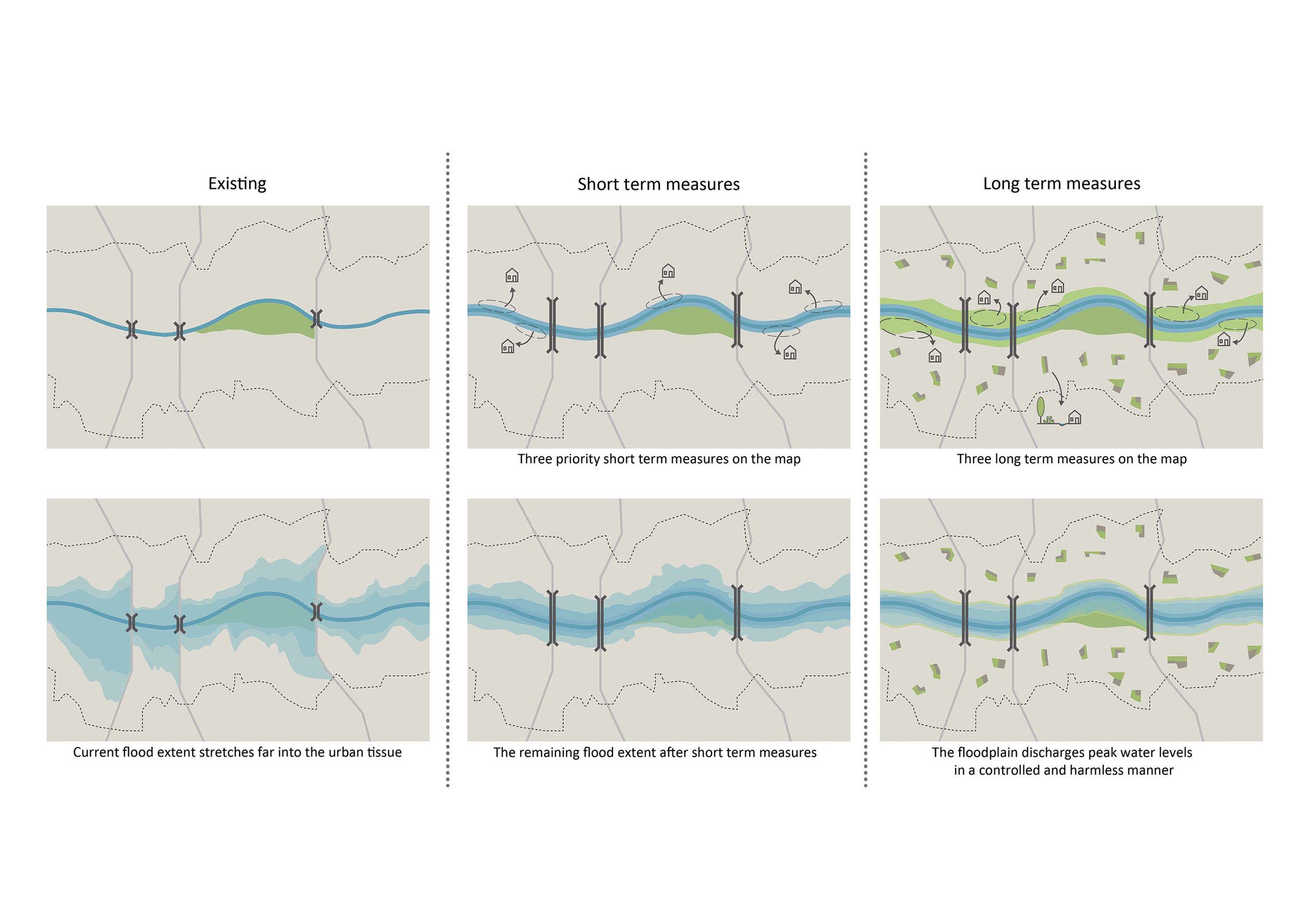
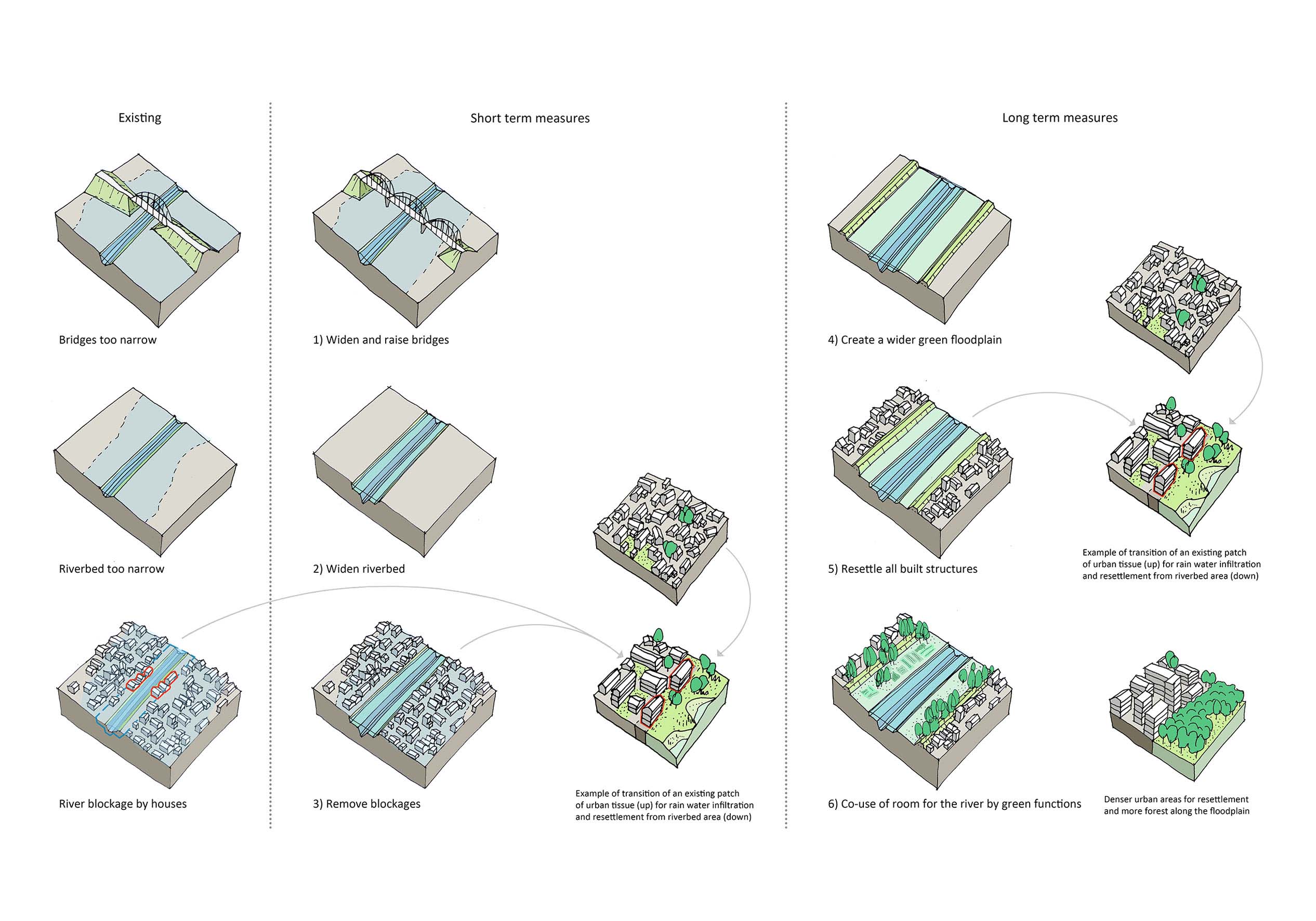
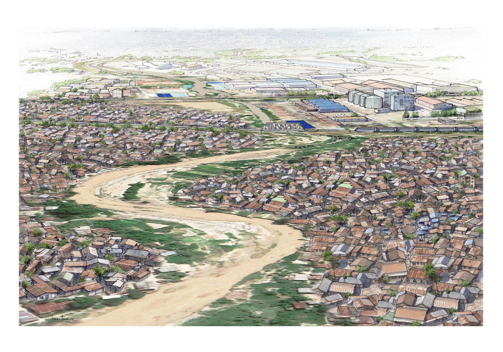
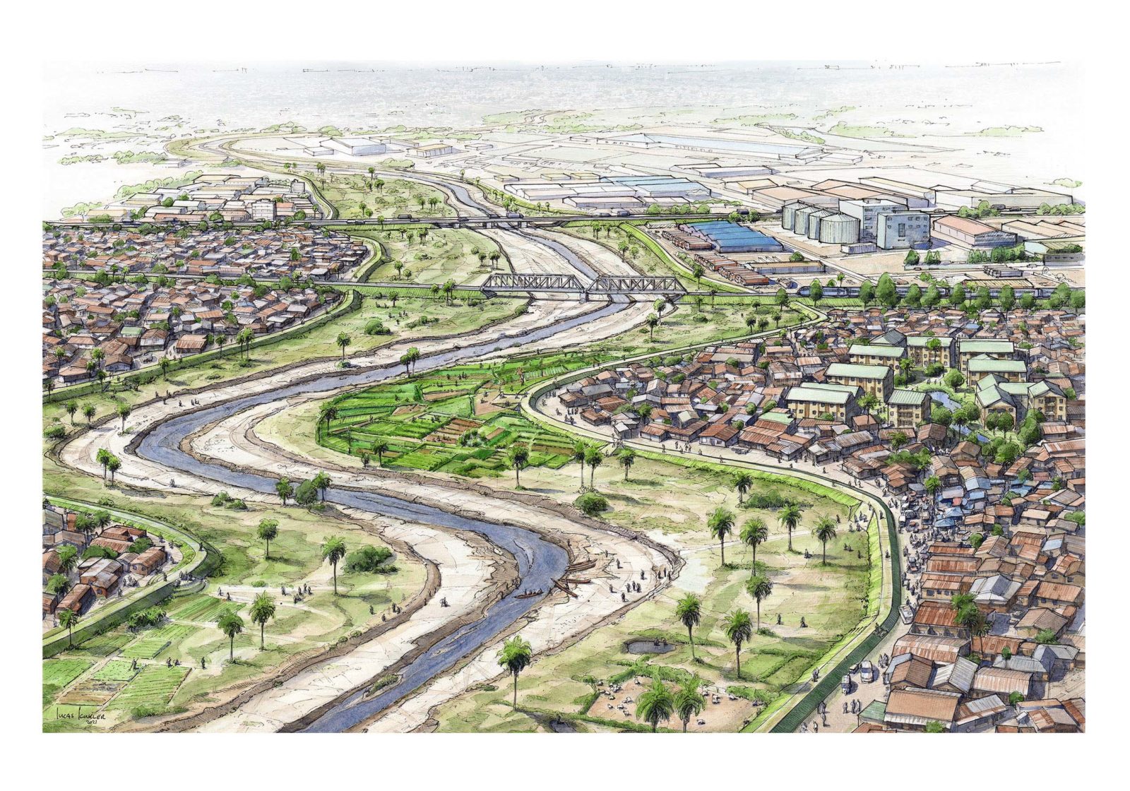
The experience gained from The Msimbazi Opportunity Project was used by GIZ to formulate the task for the next step in the upstream area of the Msimbazi River Basin. In a transdisciplinary collaboration with CDR International BV, the technical and financial expertise blended with spatial expertise in order to create a sustainable and realistic framework of measures targeted towards flood management in the Middle Basin of the Msimbazi River and the consequent urban resettlement of the affected population in this part of Dar es Salaam. This feasibility study consists of short and long term measures, allowing for a phased implementation and clearly prioritizing the most crucial aspects of the proposal. The intervention elements are proposed in the form of a toolbox from which they can be applied along the main river and the tributaries.
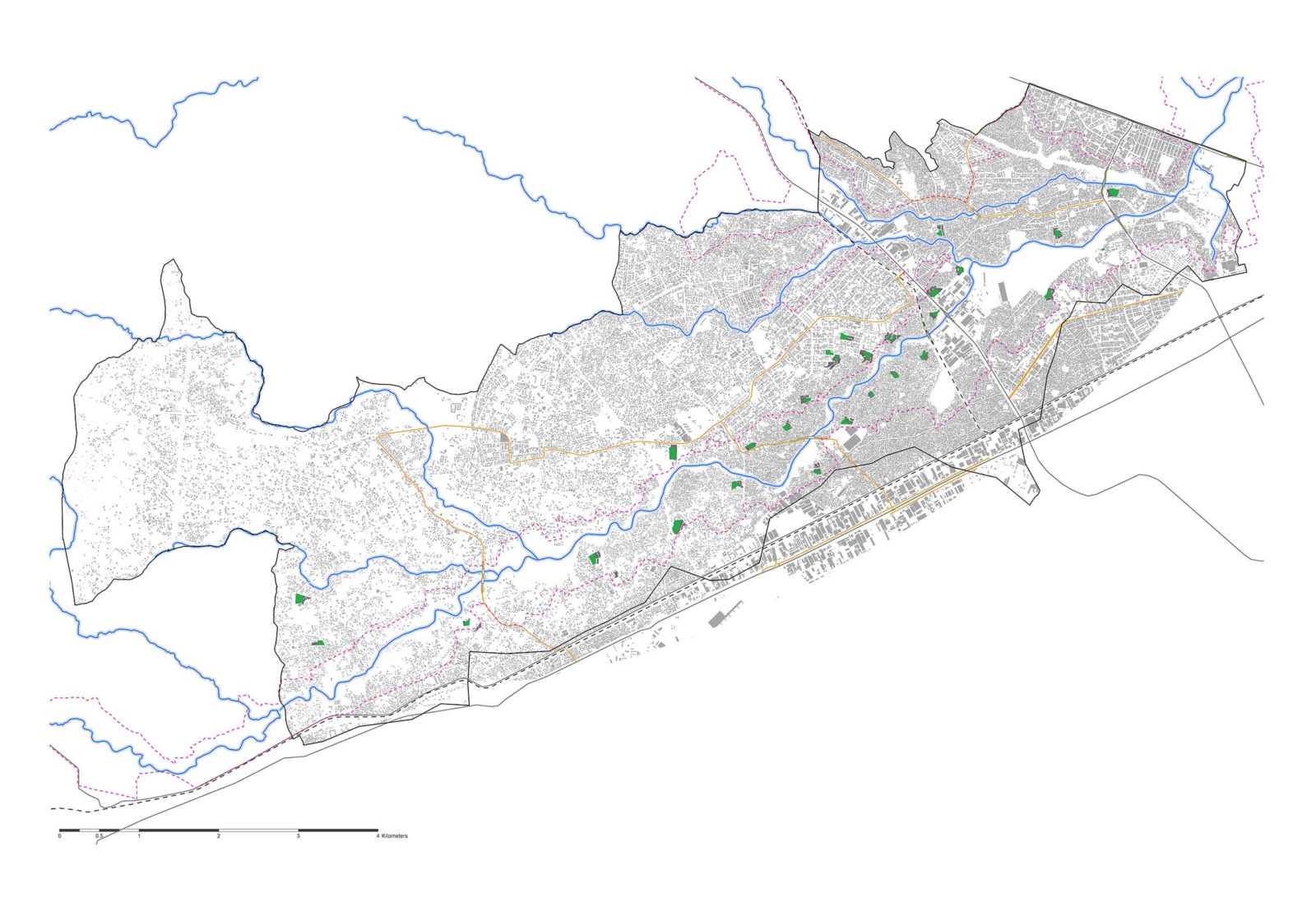
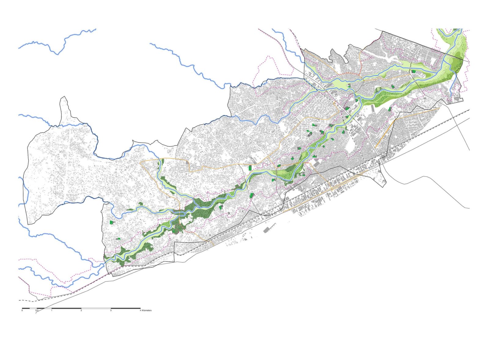
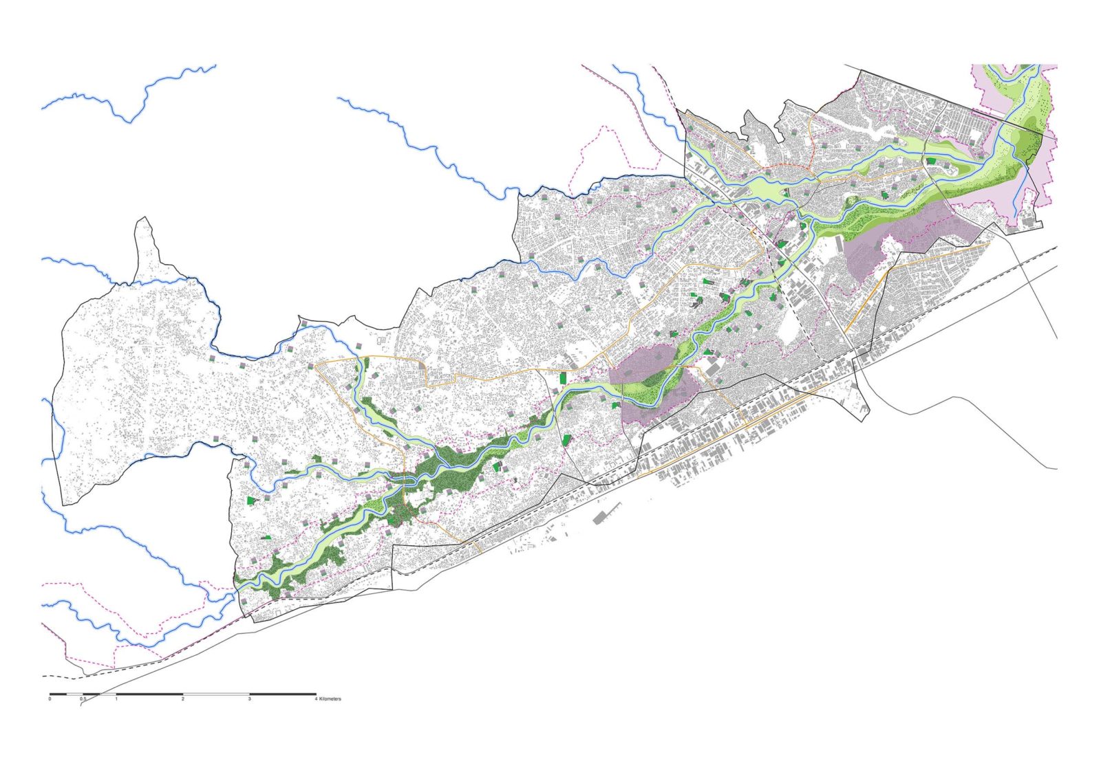
This sequence of measures from widening and raising the bridges and deepening and widening the riverbed is the core of the interventions of the project. Based on the modelling results of remaining flood extent and inundation depths, further actions on the long term are needed. Depending on the location these are widening the floodplain on the sides of the riverbed and securing edges with hidden protection solutions and small dikes at the edges of the widened floodplain. In the lower parts of the middle basin, the terraced solutions from the Lower Basin Detailed Plan can also be implemented. A series of agricultural or recreational spaces are potential uses for the newly defined floodplain. In the upper stream, part of the middle basin wooded areas are appointed to replant forest, retain more rainwater and reduce run-off. For the measures on the long term, many people need to resettle. Currently over 15.000 houses are located in the very vulnerable area along the river. An area that needs to be freed up to allow the peak water capacity of the river space and avoid damage and casualties in a much wider area. This resettlement strategy has been developed into a sustainable urban development scenario for the current inhabitants of the floodplain. The resettled population is offered a safer future in new, densified residential areas with provision of green spaces in the form of small patches in the urban fabric or larger area developments in the areas of Sukita and Liwiti. Large damage costs can be avoided on the long run and the cost of resettlement can partly be financed from cross-subsidy from commercial residential real estate within the larger area developments.